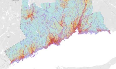
The Resilient Connecticut team held workshops in four Councils of Governments (COGs) regions in the last week of May, 2021. Merging past planning with climate vulnerability science, the team highlighted areas at-risk for more intense flooding and heat. Group conversations focused on places needing climate planning solutions or those that present “resilience opportunities” in New Haven and Fairfield Counties. These areas are not just places at risk from high heat or high flooding. They are also areas with high social vulnerabilities, regional assets like wastewater treatment plants, water supplies, energy facilities that serve multiple communities, and may have the potential to support more resilient transit and housing. Gaining local knowledge and expertise through engagement like these workshops are important as we wrap up Phase II of the Resilient Connecticut project.
Check out the Climate Change Vulnerability Index (CCVI) page for more information, including a Story Map to find tabs for the heat and flood CCVI map viewers, a viewer that shows combined vulnerability of both heat and flood, and a map presenting the resilience opportunity areas. You can also review the information packets with details on each mapped area below.
| South Central Regional COG (SCRCOG) | SCRCOG Workshop Presentation | Information Packet |
| Metropolitan COG (MetroCOG) | MetroCOG Workshop Presentation | Information Packet |
| Western Connecticut COG (WestCOG) | WestCOG Workshop Presentation | Information Packet |
| Naugatuck Valley COG (NVCOG) | NVCOG Workshop Presentation | Information Packet |