Capacity Building Studies
CIRCA is supporting and working with interdisciplinary faculty and their research teams on the following topics - go to each page to read about the project, deliverables, and faculty leading the effort.
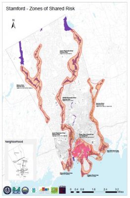
Defining Zones of Shared Risk
Zones of shared risk are regions that face common challenges either in existence already or caused by climate change, and therefore risks are shared among or between groups of people that may have different perspectives and priorities for coastal resilience. A Zone of Shared Risk (ZSR) includes the houses, land, infrastructure, hydrological, ecological, social, and institutional elements that contribute to the functioning of a place. The goal of this project is to to identify ZSR in New Haven and Fairfield counties and connect these zones with resilience corridors to link critical facilities and provide greater continuity of service to the lower-lying communities.
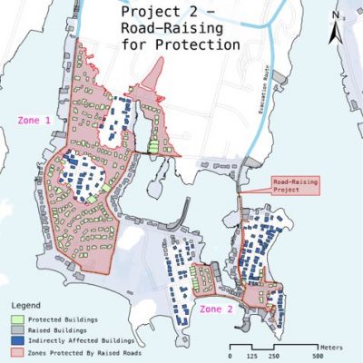
Costs and Benefits of Flood Risk Reduction
Connecticut’s coastline is vulnerable to tidal flooding from its rivers and Long Island Sound. In addition, this coastline is characterized by a complex topography with large presence of bays, harbors, coves, as well as wetlands and hills. This complexity affects the spatial distribution of human and physical capital in the region and thus the economic efficiency of any strategies designed to protect them from storm surges. In this study, the research team conducted cost-benefit analysis of various flood risk reduction plans in New Haven and Fairfield counties.
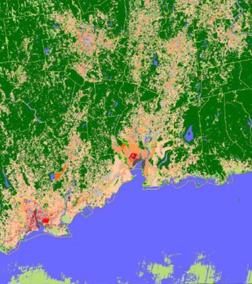
Identifying the Change in Heat Vulnerability and Land-use Influence
Extreme heat and cold are among the leading causes of climate vulnerability in the United States due to potential impacts on human health and well-being. This project aims to identify variations in air and surface temperature over time and their linkages to land cover and land-use changes. The outcomes of this project are critical to support local decision-makers in determining the thermal vulnerability of local communities in New Haven and Fairfield Counties.
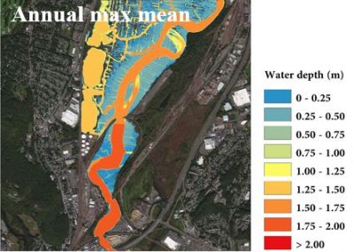
Extreme Precipitation and Riverine Flood Risk Analysis
Detailed representations of riverine flooding prepares coastal urban areas for inundation hazards. This project focuses on hydraulic modeling of extreme flood events including precipitation and water surface elevations in New Haven and Fairfield counties. The goal is to demonstrate the exacerbated effect of river flows with rainfall and sea level rise estimation in different climate change scenarios.
Transit Oriented Development Challenges and Opportunities
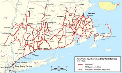
Transit Oriented Development (TOD) is an important tool for climate mitigation and resilience. TODs are mixed-use, compact, walkable developments built in locations that are served by high quality transit systems. The purpose of this project is to evaluate the potential for TODs as a key component for long term climate resilience along the New Haven – Greenwich corridor by doing an evaluation of the challenges and opportunities for the creation of TODs.

Legal and Policy Tools for Climate Resilience at the State and Local Levels
States and local jurisdictions strive to serve their constituent needs by crafting responsive legislation and regulation to meet current conditions, rectify previous inadequacy, and anticipate future need. This project has two goals differing in scale. The first project goal is to compare Connecticut resilience planning legal needs to other states’ climate resilience legislation. Second, the project will evaluate the specific regulatory needs of municipalities in the affected project area and develop regulatory suggestions municipalities could adopt to meet those needs on the local level.

Extremal Dependence, Forecasting, and Flood Warning Alert Generation Based on Water Level and Wave and Wind Variables in Coastal Towns
This project investigated coastal flooding risks through two main directions. First, the research team used advanced statistical methods to study how wind, precipitation, and sea-level interact to drive compound flood events in Bridgeport, Connecticut. Second, they evaluated forecasting models for sea-level exceedance in New Haven, finding that the best approach depends on the forecast horizon.

Addressing Disaster Preparedness-Disparity in Connecticut: Cultivating Trust and Increasing Resilience through Effective and Equitable Risk Communication
This applied research sought to provide guidance on the types and form of hazard-related information most desired and sought after by residents, particularly minoritized and impoverished residents, for policy-makers and state, regional, and municipal disaster management personnel; as well as underling the needs of increasingly overburdened emergency management directors across the
state.

Flood Insurance-Pricing, Coverage, and Distributional Impacts for Underserved Communities
This project examines how low-income households navigate the complex and costly flood insurance system. Although they own fewer assets, these households are often most vulnerable to flood damage and face higher insurance costs due to living in riskier areas and lacking resources for mitigation or renovations. The analysis focuses on participation in the National Flood Insurance Program, how decisions differ for lower-income households, and how these choices affect program effectiveness, using hazard models to assess changes in policy status over time.