Data Viewers
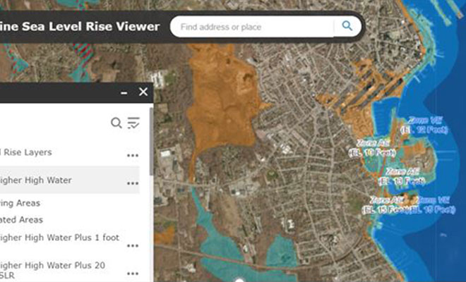
Connecticut Sea Level Rise and Storm Surge Viewer
This dataset shows different flood maps with return periods and sea-level rise projections above a Mean Higher High Water (MHHW) along the Connecticut coastline and the adjacent inland. CIRCA research recommends that planning anticipates sea level will be 20 inches higher than the national tidal datum in Long Island Sound by 2050. CIRCA’s report on Connecticut sea level rise provided the basis for projections in Bill S.B. 7, which was introduced into the 2018 legislative session and was enacted into law as Public Act 18-82.
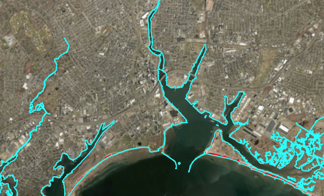
CREST Viewer
Five points distributed along the shoreline of Connecticut were chosen as locations for reporting results from the wave modeling work funded by a two-year grant from the National Oceanic and Atmospheric Administration (NOAA) to the University of Connecticut. There is a page for each point, 8797, 12470, 15631, 16339, 18277, as well as some information in the map when the point is clicked. The blue squares are two NOAA buoys. The viewer legend explanation can be found here.
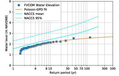
Connecticut Coastal Towns Storm Annual Exceedance Probability/Return Interval Viewer
This dataset shows the annual exceedance probability (or return period) of storm surge water levels and significant wave height for each of Connecticut's 24 coastal towns obtained from coupled circulation-wave model (a recent Journal of Marine Science and Engineering article outlines this modeling approach). Results highlight storm surge water levels and significant wave heights, which may contribute to a better understanding of extreme storms and guide decision-makers.
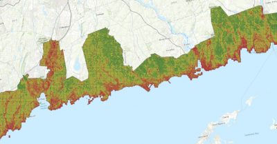
Connecticut Coastal Vulnerability Index Viewer
This map viewer shows the influence of different factors at a range of locations to the effects of sea level rise. The GIS mapping helps visualize the relationship between environmental, socio-economic, and built contributors in terms of exposure, sensitivity, and adaptive capacity. A high to low ranking of coastal area vulnerability to sea level rise is indicated.