Data Sets
Connecticut Sea Level Rise and Storm Surge Viewer Dataset
This dataset shows different flood maps with sea-level rise projections (1 foot and 20 inches), above the North American Vertical Datum of 1988 (NAVD88) along the Connecticut coastline and the adjacent inland. This dataset contains storm surge extend of 10, 30, 100, and 500 year flood events with return interval or 10%, 3.33%, 1%, and 0.2% annual exceedance probability storms, as well as anticipated 20 inches of sea level rise by 2050.
Connecticut Coastal Towns Nearshore Model Storm Surge and Wave Height Dataset
The FUNWAVE TVD model outputs of Super Storm Sandy and 1% annual exceedance probability (AEP) storm scenario for Branford, Norwalk, and New Haven, CT. This dataset contains the wave height, water elevation during the stated storms at a finer resolution considering the complex nearshore dynamic on the shore.
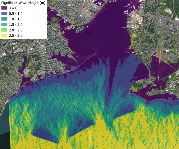
Connecticut Coastal Towns Storm Surge and Significant Wave Height Dataset
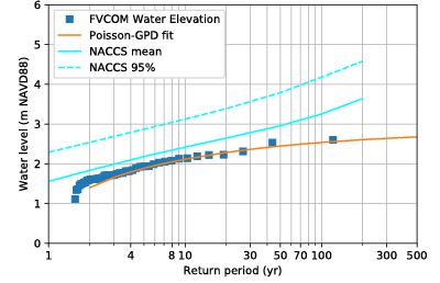
The study modeled Long Island Sound using a coupled coastal circulation and wave model (FVCOM-SWAVE) and hindcast 44 storms between 1950-2018. The dataset contains the empirical probability results that fit to Poisson-GPD distribution. The storm surge water level and significant wave heights for the specific event annual exceedance probability is provided for 24 Connecticut coastal towns.
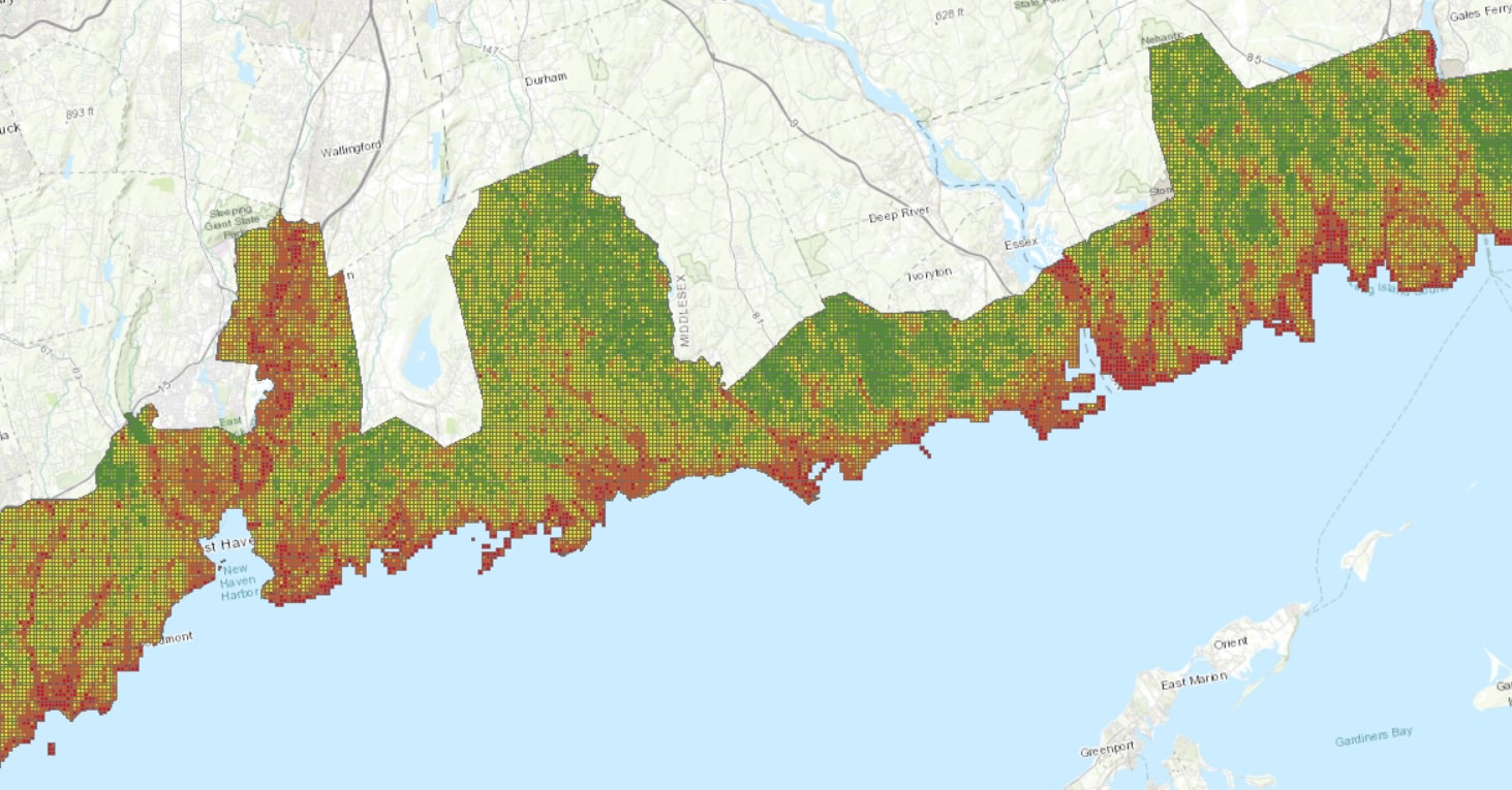
Connecticut Flood Maps for Different Storm Annual Exceedance Probability/Return Intervals
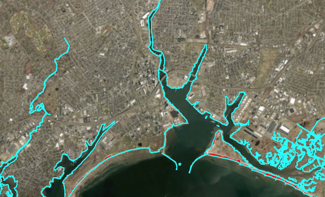
The study modeled Long Island Sound using a coupled coastal circulation and wave model (FVCOM-SWAVE) and highest hindcast 44 storms between 1950-2018. The dataset contains the projected storm surge water levels of empirical probability results on the 2016 LIDAR topography data.